Tropical Storm Jangmi slightly strengthens outside PAR
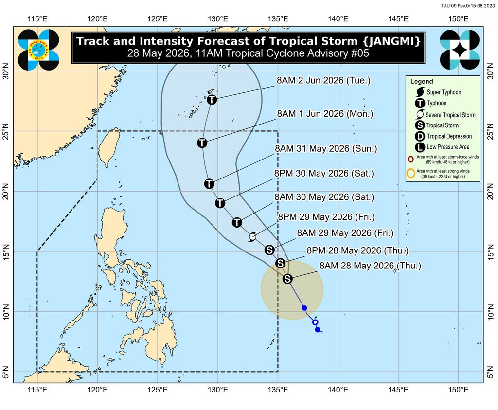
MANILA, Philippines – The tropical storm with the international name Jangmi slightly intensified on Thursday afternoon, May 28, ahead of its expected entry into the Philippine Area of Responsibility (PAR).
Once it enters PAR — either on Thursday evening or early Friday morning, May 29 — it will be given the local name Domeng.
The Philippine Atmospheric, Geophysical, and Astronomical Services Administration (PAGASA) said Jangmi was already 1,235 kilometers east of southeastern Luzon as of 3 pm on Thursday, slowly moving north northwest.
The tropical storm’s maximum sustained winds increased from 65 kilometers per hour to 75 km/h. Its gustiness is now up to 90 km/h from the previous 80 km/h.
PAGASA earlier said Jangmi is likely to strengthen into a severe tropical storm on Friday, and subsequently into a typhoon by Saturday, May 30.
The weather bureau added that the future Domeng may reach its peak intensity between Saturday and Sunday, May 31, while over the Philippine Sea.
The tropical cyclone is expected to stay over the Philippine Sea, far from landmass. But it may trigger moderate to rough sea conditions in the seaboards of extreme Northern Luzon during the weekend.
Jangmi may also begin to enhance the southwesterly windflow — the precursor of the southwest monsoon or habagat — on Saturday.
On Thursday evening, the southwesterly windflow will bring scattered rain and thunderstorms to Western Visayas, the Negros Island Region, Zamboanga Peninsula, Soccsksargen, Bangsamoro Autonomous Region in Muslim Mindanao, and Palawan.
Meanwhile, Jangmi’s trough or extension is still affecting the rest of Mindanao, also causing scattered rain and thunderstorms.
Other parts of the country are seeing generally fair weather, with just localized thunderstorms.
PAGASA is expected to soon declare the start of the rainy season, which typically begins in the second half of May or the first half of June. – Rappler.com


You May Also Like

Japan firms to boost PHL investments

Argentina Bill Prohibits Crypto Payments to Illegal Gambling Sites

Exclusive interview with Smokey The Bera, co-founder of Berachain: How the innovative PoL public chain solves the liquidity problem and may be launched in a few months